



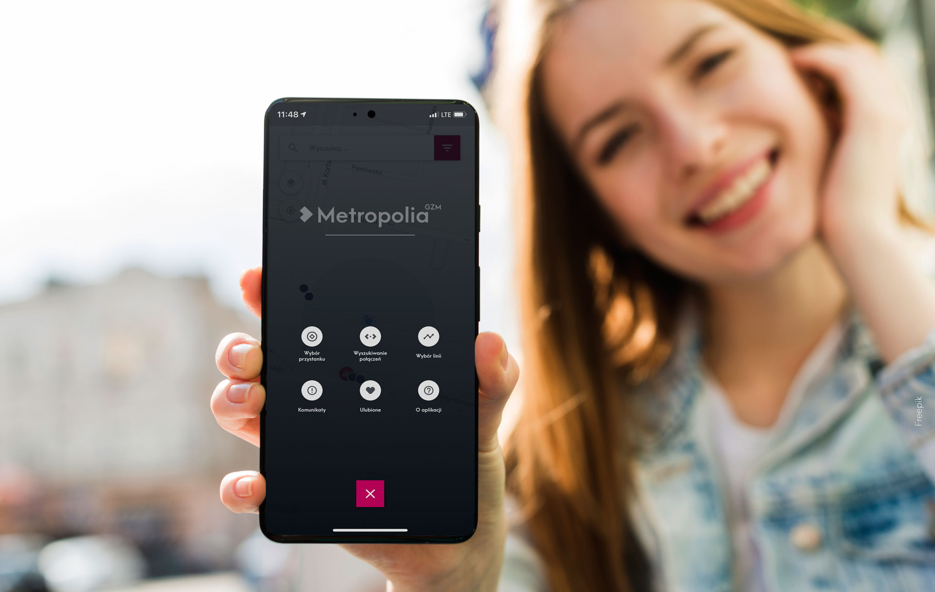
GZM Metropolis has released a mobile application for smartphones for passengers using public transport. The app is provided by Dysten company, which finalizes the implementation of the entire Dynamic Passenger Information System, including SDIP boards.
M2GOinfo will help you plan your bus or tram trip
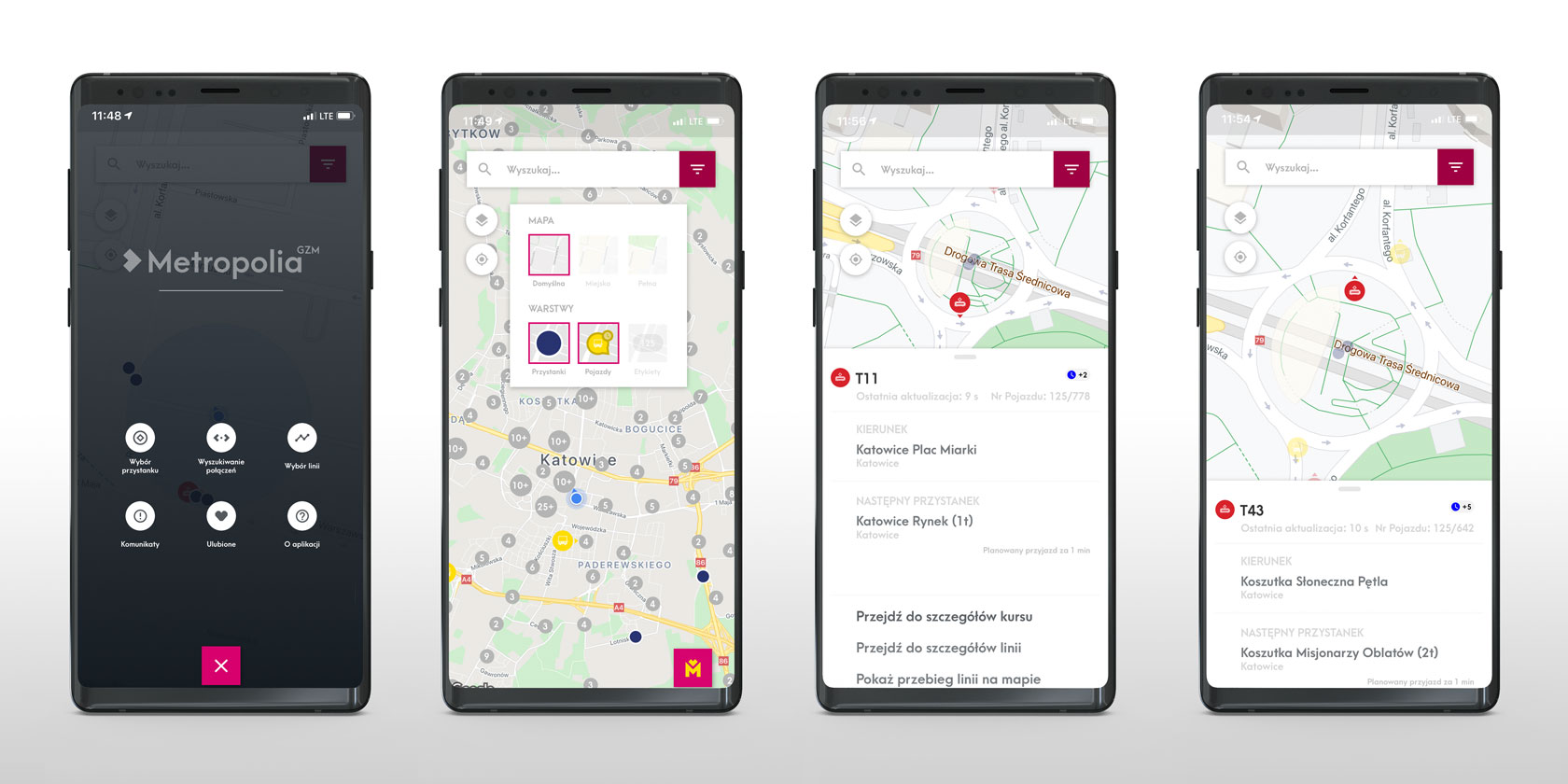
Mobile phone users are the fastest-growing group of public transport users. The production version of the application is now available for download and installation in the Google Store. The same will soon be available to users of Apple smartphones with iOS. The program has been developed in such a way that planning a route requires as few clicks as possible by the user. The universal search panel helps you quickly find a stop or a line. Tapping the search bar displays the search results, and expanding the menu gives you access to various options, such as:
- Stop selection
- Searching for connections
- Line selection
- Messages
- Favorites
- About the application
Map and its layers
By default, the map layer with the network, street names, neighborhoods, and cities is visible. Turning on the Urban layer will display the outlines of buildings, and the Full layer – will add Parks, Squares, water objects, etc. It is possible to turn on and off Stops, Vehicles (tram, bus, direction, information about delay) and Labels, which will indicate the line number.
Searching
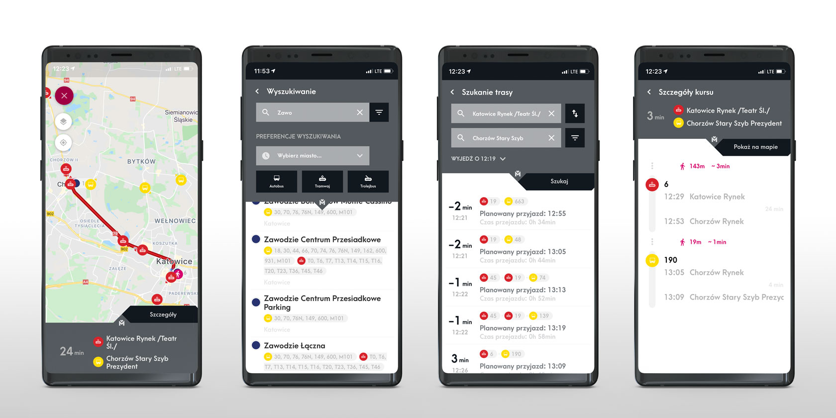
The search engine is a key feature that makes life easier for the user. Entering a string of characters starts a dynamic search in the database of objects and transport data. The system suggests possible results, so entering “Kat” will make available all records containing the letters or string mentioned in the name, eg Katowice. Options allow you to view the details of a Line or a Stop. By default, the system looks for the next hourly departures.
Zoom in and out on the map
The map supports a typical zoom. Zooming out groups and reduces the number of stops, and the icon displays the total number of items. Zooming in allows you to view full, detailed information again. The application supports transparency, which increases the ease of reading the data and the overall transparency.
Context Menu
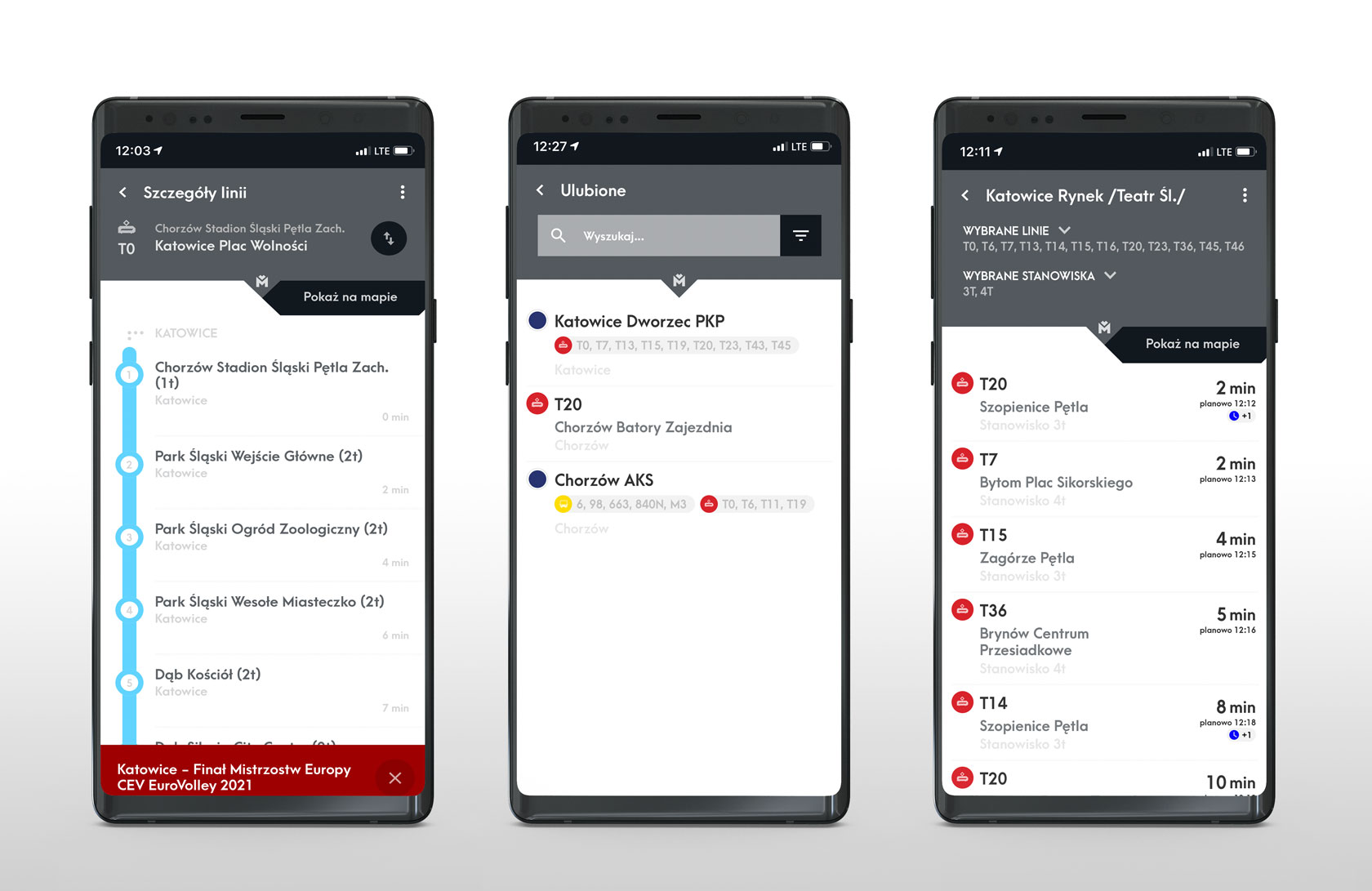
Touching the vehicle context menu displays the line number, direction, delay, next stop and real time of arrival. The details of the line, course, route plotted on the map will appear there.
The contextual menu of the stop will display the name of the stop, the position (valid at the transfer center or station), a list of lines departing from it and information whether there is a bus or a tram. From this position you can also search for any connections from a specific stop.
Choice of line, tram or bus
Clicking on the filter icon starts Preferences, where we can easily choose the location or the preferred means of transport.
Destination details
Selecting the direction (destination) allows you to view the list of stops. We can easily change the destination by clicking on the appropriate icon, and the diagram will display details about the time of arrival from the beginning of the line and from the previous stop. The colours change with each zone. The system can also handle variant routes, always displaying the real-time information.
If we use specific tram or bus line every day, it is worth adding them to your favorites – it saves a lot of time.
Messages & alerts
It happens that the bus or tram breaks down. Metropolis provides detailed warnings in such situations in the application. The passenger app runs smoothly even on older smartphones.
Digital passenger information in comparable procurements
This project demonstrates DYSTEN’s experience in the design, manufacture, supply, integration and commissioning of the stated technology. In comparable procurements, DYSTEN can deliver a defined equipment and system package or, where appropriate, a complete solution, with clear interfaces for the contracting authority, system integrator and main contractor.
Related CPV / tender codes
- 48813000 Passenger information system Core code
- 48813200 Real-time passenger information system Additional code
Project / solution scope
- Software
- System integration